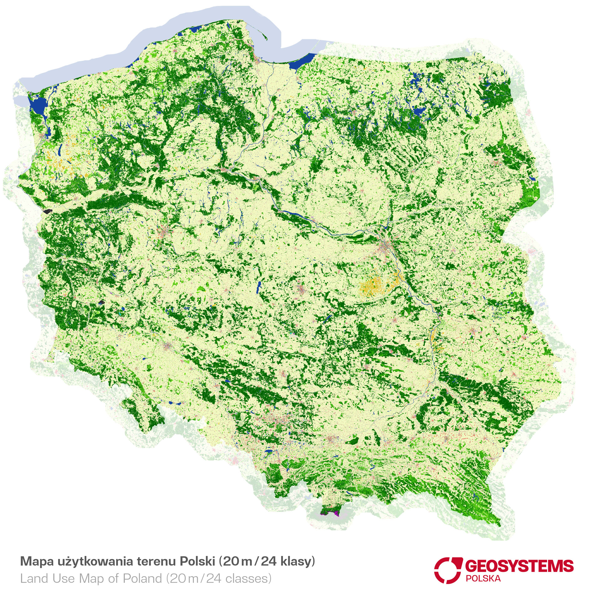
The land cover map (landuse/landcover/clutter) developed in GEOSYSTEMS Polska is a coherent raster resource with a terrain resolution of 5 and 20 meters, developed for the entire Poland based on the analysis of aerial and satellite images.
A land cover map is a graphical representation of an area that indicates various types of land use, vegetation distribution, terrain structure, and other information regarding the geographical features of a given area. Land cover maps are used in various fields such as geography, land use planning, environmental protection, earth sciences, as well as in the military field and scientific research.
Land cover maps are a key tool in spatial planning, enabling the analysis of land use and development as well as changes occurring therein. They help to understand how specific areas are used and what the land uses in a given area are. Thanks to them, it is possible to take better actions to maintain sustainable development.
The basic data source for creating the GEOSYSTEMS Polska land cover map was the IRS-P6 Resourcesat satellite imagery set with a resolution of 5 m. The analysis of IRS-P6 orthoimages first included automatic supervised object classification performed in the Trimble eCognition® software, thanks to which the image was divided into pixel segments with similar spectral characteristics, then assigned to specific land cover categories. The use of advanced object-oriented classification methods and artificial neural networks in production speeds up data processing and improves the quality of data (➭see video).
An important stage is the visual control of the classification effects carried out using both satellite material and available reference data. For urbanized areas, we use visual interpretation of high-resolution orthophotomaps.
This data is constantly updated and developed thanks to technological progress. The use of satellite technologies, drones and other tools allows for obtaining increasingly accurate and precise sources, which translates into their higher quality.