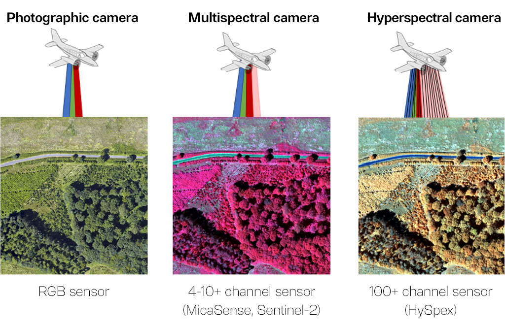
A hyperspectral camera can be an extremely useful tool in precision agriculture due to its ability to collect image data of plant cover and soil in a very wide spectral range and the high spectral resolution expressed in hundreds of channels (spectral ranges) of the resulting image.
The main goal of the GyroScan project was to develop a remote sensing, comprehensive method for determining the needs of irrigation, fertilization and chemical control treatments in the context of the requirements and goals of precision agriculture. At the same time, this method can be used to assess the state of degradation of meadows (the measure of degradation is the degree of biodiversity of vegetation occurring in the examined meadow) and to assess the intensity of carbon dioxide and methane exchange between the active surface and the atmosphere.
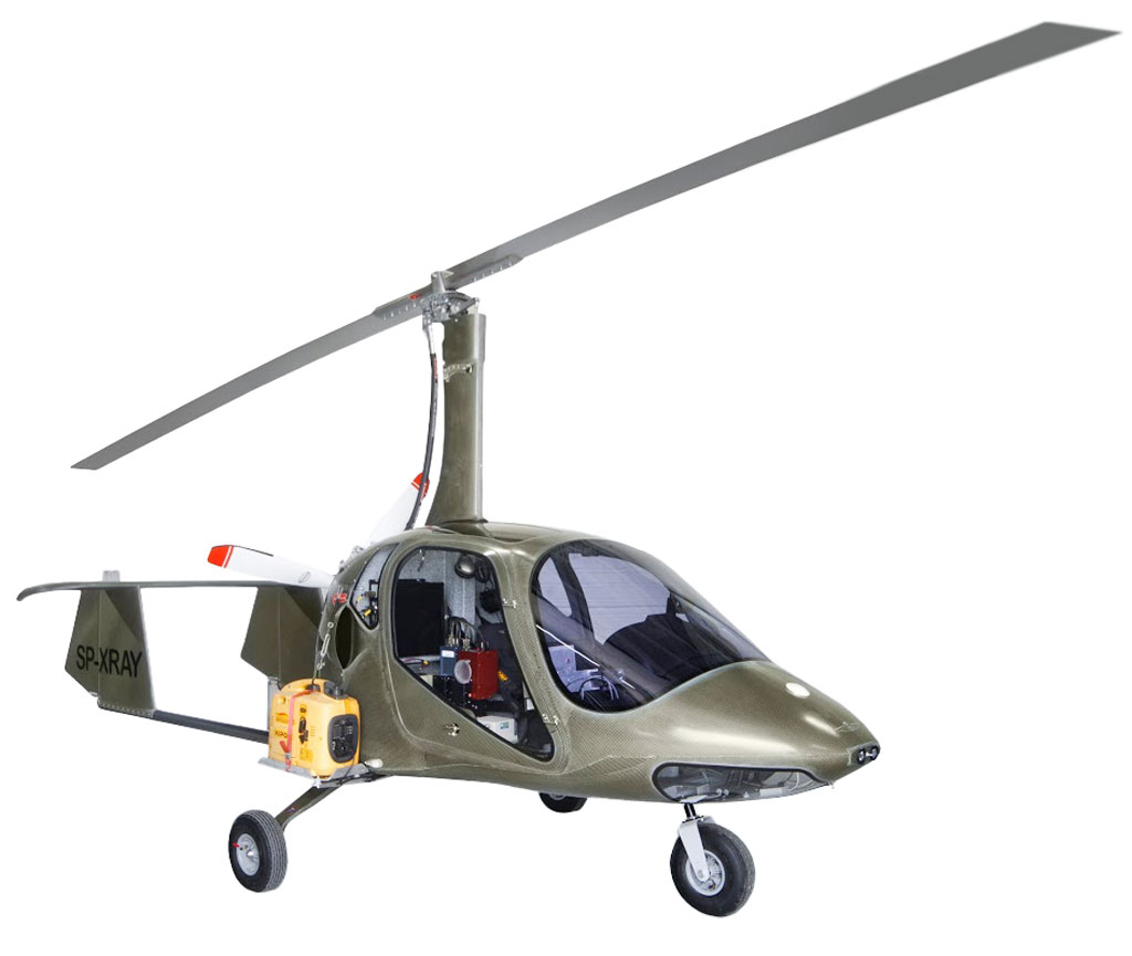
To carry out imaging tasks, the HySpex hyperspectral camera was used, placed on board of an ultralight aircraft – a gyroplane.
A gyroplane is an aircraft (from the rotorcraft family) equipped with a rotor and a pusher type propeller. The main rotor is not driven by the engine, but moves thanks to the phenomenon of autorotation, i.e. using the translational motion of the gyroplane forced by the pusher propeller. Taking off and landing a gyroplane requires a very short distance and is possible on grassy areas. Its advantages are: useful speed (approx. 90 km/h), high maneuverability and low operating costs.
Results obtained in the GyroScan project:
- significant reduction in the costs of obtaining data on the condition of agricultural fields/meadows – the operation of a gyroplane is much cheaper than airplanes, and at the same time the limitations associated with the use of unmanned aerial vehicles are avoided (e.g. limited operating time of drones making it difficult to monitor large-area crops),
- positive verification and recommendation of the acquired hyperspectral imaging data – they contain a coherent and rich set of spectral information for the entire crop area, which allows the elimination of costly and time-consuming field tests of soil and plants,
- creation of a unique support system for precision agriculture allowing for adjustment of fertilizer doses to the real needs of specific locations within the crop, and thus significant optimization of fertilization, resulting in significant cost reduction and measurable benefits for the natural environment,
- development of a quick, efficient and cheap method for assessing the state of meadow degradation allowing for making rational decisions regarding, among others, drainage and purpose of these economically and naturally important areas,
- using the system to assess the exchange of carbon dioxide and methane (basic research), which allows for faster, cheaper and easier acquisition of data for the greenhouse gas balance.
The Gyroscan project was carried out as part of the 2nd competition Natural Environment, agriculture and forestry BIOSTRATEG together with Institute of Agrophysics of the Polish Academy of Science in Lublin, University of Life Science in Lublin, Institute of Geodesy and Cartography, Plant Protection Institute and with companies Aviation Artur Trendak and Lesaffre Polska S.A.
Please visit the project website.